
By Jaymo Wa Thika,
The first construction works for Makongeni Estate in Thika were done in the early 1970s; around 1972 to 1974. It was developed by the Kenya Railways Corporation (KRC) as a housing estate for railway workers.
This was part of a broader post-independence government initiative to provide structured housing for civil servants and parastatal employees.
🕰️ Why was it called Makongeni?
There is this theory that states that the name “Makongeni” was derived from the Swahili word “Makongo”, which means sisal. Before urban settlement, this area was covered in expansive sisal plantations, a major colonial-era crop in Thika.
The plantation economy attracted African labourers, and later, when Kenya Railways expanded operations, the government built formal housing for its workers here in the early 1970s.
The name "Makongeni" was retained in honor of the area's sisal roots.
📍 Location, Size & Administrative Identity
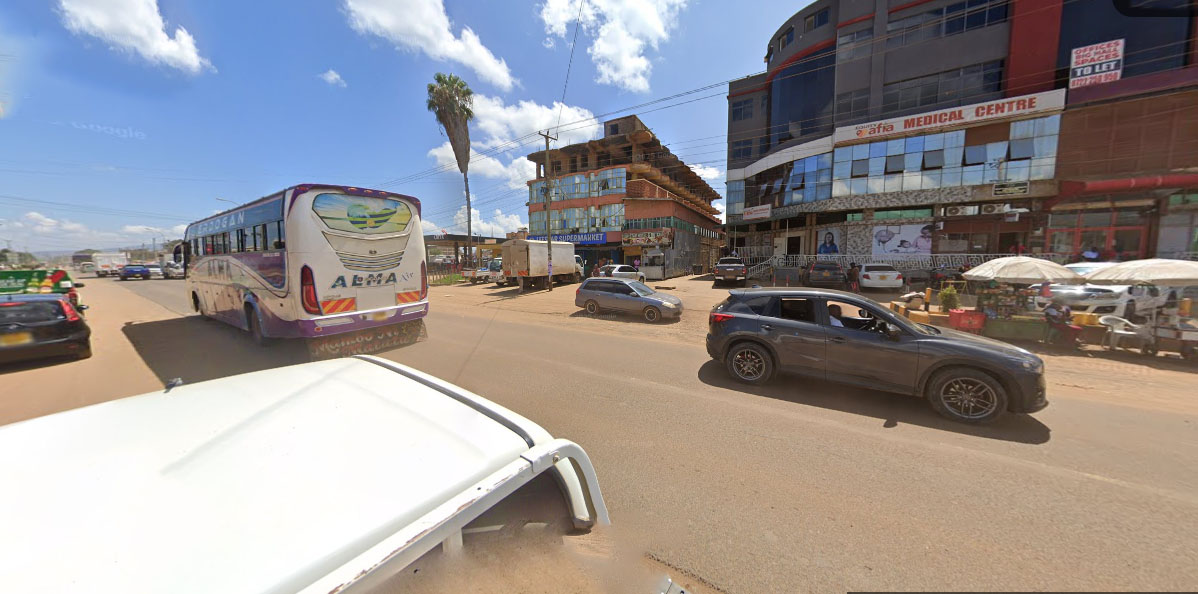
Makongeni lies 4.5 km southeast of Thika CBD, along the Thika–Garissa Highway, spreading into Kamenu, Kisii and Kiganjo areas.
It falls under Makongeni Sub-Location, Kamenu Location in Makongeni Division of Thika Town Constituency.
Politically it is in Kamenu Ward of Kiambu County.
As of recent local administrative estimates (2023), Makongeni hosts over 65,000 people with approximately 12,000–15,000 registered voters.
🧱 Naming of Makongeni sections
Makongeni today is divided into 13 phases, each representing a wave of settlement and development:
🔹 Phases 1–3 (1970s–80s)
This were planned and constructed for Kenya Railways and civil servants, majority being permanent stone houses with shared compounds, piped water, functional sanitation.
They are the oldest section, situated closest to Thika-Garissa Highway (A3 road), just behind the former Kenya Railways houses.
🔹 Phases 4–5
These were mostly allocated to former Kiandutu slum residents in the 1980s, who built mabati and mud single and double rooms houses.
The initial planning and demarcation of Makongeni Phase 4 began around 1983–1985, during a period when the government and local authorities were under pressure to address rising informal settlements and growing populations in Thika.
Actual settlement and construction by residents especially those from Kiandutu slums began in the late 1980s into the early 1990s.
These areas were initially occupied by low-income earners, hustlers, unemployed populace and casual workers. Some plots grabbed or sold off to outsiders or speculators
Up to today Phase 4 and 5 are known as a hustler base, rough but vibrant; a mix of resilience and struggle; strong community ties, but under-serviced.
🔹 Phases 6–8
Initially, these areas were occupied by teachers and factory workers and evolving into a middle-low class residential area.
Compared to Phases 4 and 5, they had improved access roads, but mixed planning but with water and sanitation infrastructure under strain
🔹 Phases 9–12
These ones emerged in the late 1990s and early 2000s with a boom in rental housing and were more established and decent, mostly for the middle and upper class tenancy, gated homes and small estates.
Inhabitants included workers in higher cadres and with small families
🔹 Phase 13
This is the newest and most modern section and the most decent of all the others. These were SACCO-developed plots, gated homes, small estates
It is a rising middle-income zone near Gretsa University that has attracted people from Nairobi.
🏗️ How Makongeni Was Ingeniously Planned
One of the most remarkable and often-forgotten facts about Makongeni is that it was developed under the Site and Service Scheme (S&SS) a brilliant housing model that emphasised community ownership, urban planning, and self-driven development.
Citizens were allocated plots for free by the government. In return, they paid a modest fee for common services: water piping, sewer lines, all-weather access roads etc.
Each plot was assigned an identification number beginning with S&SS, later shortened to SSS. For instance: 👉 SSS7/66 = Phase 7, Plot No. 66
📐 Strict Planning and Construction Rules:
The then Thika Municipal Council drew up uniform house plans, issued them to allottees, enforced strict timelines to start and complete construction within the agreed timeline.
Anyone who failed to build in time lost their plot, which would be re-allocated to someone else. Original allottees who lacked the money to build sold their plots to wealthier individuals who could afford to construct within the timelines
🧱 Quality and Enforcement:
The Council inspected every construction phase and any attempt to alter the approved designs or add illegal extensions (e.g., building 8 rooms instead of 7) would be stopped immediately, and in some cases, walls demolished by municipal staff
Kenya was once a serious nation where laws were ruthlessly enforced,” residents often recall.
⏱️ Result: Rapid and Orderly Development
By the mid-1980s, Makongeni had developed so fast that there were more houses than tenants a rare case in Kenyan urban housing history. This model could serve as an example for future housing projects nationwide.
🏘️ Kamenu Estate – The Gated Gem Inside Makongeni
Tucked within the broader Makongeni layout, Kamenu Estate is a planned, gated residential zone located between Phases 8, 9 and 11. Unlike the surrounding high-density tenements, Kamenu stands out for its uniform, single self-contained housing units and orderly compound layout.
The estate was constructed in the early to mid-1980s by the Government of Kenya as part of its effort to provide decent housing for civil servants, including police officers, teachers, and other government employees stationed in Thika.
The estate was managed under municipal rental housing by the defunct Thika Municipal Council, which maintained the units as public rental property until the early 2000s.
In the period between 2003 and 2006, following the push for housing reforms and privatisation of public assets, the Thika Municipal Council began selling the houses to sitting tenants under a Tenant Purchase Scheme. This allowed the original occupants to buy the homes they had lived in for years — many at subsidised rates.
This transition marked a major shift in Kamenu’s history, as it gave residents full ownership, resulting in improved maintenance, gradual renovations, and a stronger sense of community identity.
Today, Kamenu remains relatively organised, secure and well-regarded, though it too, is gradually facing the pressure of modernisation and informal extensions.
🌐 Neighbours & Industrial Belt
Makongeni is bordered by Kiganjo, Kiang’ombe & Kisii estates, some of Thika's rapidly growing residential-commercial areas.
Nearby are major industries offering employment. They include:
• Thika Main Jua Kali
• Kevian Kenya
• Kenya Cereal Board
• Kenblest
• KEL Chemicals
• Polysack
• BAT
• Capwell Industries, among others.
🏛️ Landmarks, Institutions & Health
🏢 Landmarks
• Makongeni Post Office & Bus Park
• Makongeni Police Station
• Madaraka Market
• Ananas Mall
• Kamenu Trading Centre
🏫 Schools
• Bishop Njuguna Training College (formally Christian Industrial Training College -CITC)
• Kenyatta Girls Secondary
• Kenyatta Harambee Primary
• Kamenu Primary School
• Bishop Ngoima PCEA Academy
• ACK St Luke's Church Academy
• Thika Primrose School
• Mwangaza Primax
• St. David’s Academy
• St. Mulumba Academy
🏥 Health Facilities
• Makongeni Dispensary
• St. Matias Mulumba Mission Hospital
• Mt. Sinai Hospital
• Ama Hospital
• Equity Afia Makongeni, among others
🏦 Banks
Equity, Co-op, Family, and KCB agents near Madaraka area.

🧺 Madaraka Market – Thika's Regional Trade Hub
Madaraka Market was relocated from Thika Jamhuri Market area in the early 1990s due to congestion. Today, it is a regional powerhouse, serving Kiambu, Nairobi, Murang’a, Machakos, Kitui, Garissa, and other frontier counties
Madaraka Market hosts over 600 traders and many more informal hawkers.
Key sectors:
• Fresh produce (fruits, vegetables, cereals)
• Mitumba, clothing and footwear
• Cooked food and eateries
• Chicken
• Utensils and households (Madaraka Stalls)
• Furniture and Welding (Madaraka Stalls) etc
🏗️ Makongeni Sand & Construction Material Economy
A lesser-known but thriving sector in Makongeni is the sand and building materials trade common around BAT area and near Makongeni Police Station.
The trade is operated by youth, transporters, and middlemen popularly referred to as brokers. They Supply local constructions, with links to real estate developers
🚍 Makongeni Bus Park – Thika’s Eastern Transport Hub
The original Makongeni Bus Park was constructed in the mid-1980s with the goal of decongesting Thika town and creating a local PSV hub for Makongeni and neighbouring estates. However, the facility saw little to no usage, as public transport operators preferred operating directly from Thika CBD.
As a result, the space was gradually abandoned, and by the 1990s, it was repurposed into a wholesale fruits and vegetable market giving birth to what is now Madaraka Market.
This transformation turned a forgotten public facility into one of the most important regional trading centres in Thika, now serving counties like Kitui, Garissa, Machakos, Murang’a, and beyond.
In 2017, former Kiambu Governor Ferdinand Waititu controversially acquired land belonging to Makongeni Post Office area and converted it to the now Makongeni Bus Park which has become a major factor in the lives of Makongeni residents and beyond.
PSVs serve various town service routes as well as link Makongeni to other areas of the country. We have PSVs plying:
• Local town routes (Thika CBD, Landless, Kiganjo, Gatuanyaga, Kilimambogo etc)
• Regional PSV to Kitui, Matuu, Tala, Kangundo, Garissa
• Nairobi and Western Kenya
It is also a busy hub for bodabodas, tuk-tuks and mobile vendors
🍻 Entertainment Spots
The estate features a variety of vibrant joints that cater to both youth and older residents. As night falls, Makongeni area transforms into a vibrant playground of entertainment, where music, dance and social life come alive, especially on weekends.
Famed for its sizzling nyama choma and infectious merry-making, Makongeni’s nights are a celebration of flavor, music and good company.
Other forms of entertainment include pool tables, betting centres, video games, football video halls as well as wines and spirits outlets, among others
Entertainment is a key driver of informal employment and social life in Makongeni.
⚠️ Challenges Facing Makongeni
Despite its growth, Makongeni faces several development and social challenges:
🗑️ Poor Waste Management
Many phases lack a proper garbage collection system and garbage heaps are a normal site.
Waste clogs drainage, causes pollution and health risks
Inadequate Water Supply
Several parts of Makongeni experience acute water shortages. Water rationing is common, forcing residents to rely on expensive vendors or unsafe sources.
🌧️ Flooding:
Phases 4 and the low lying areas of Phase 7, Kamenu and Phase 10 flood during rainy seasons.
🔐 Insecurity
Some areas of Makongeni report cases of muggings, theft, and gang activity
Youth joblessness fuels informal criminal networks
💊 Drug Abuse & Early Pregnancies
Increase in bhang, pills and illicit alcohol use is a big challenge among the youth in Makongeni.
Teenage girls face high rates of early pregnancy and school dropout.
Youth lacking support often turn to bodaboda, casual work, or even crime

👥 The People of Makongeni
Makongeni is home to Kenya in miniature hosting all the tribes of Kenya. Kikuyus, Kambas, Luos, Luhyas, Somalis, Kisiis are the most predominant tribes in the area.
Occupations:
• Majority of Makongeni residents are either:
• Factory and transport workers
• Traders, hawkers, mechanics
• Teachers, nurses, boda boda riders
• Students, artists, unemployed youth
It is a melting pot of resilience, ambition, and everyday survival.
💪 Strengths
Despite its challenges, Makongeni’s strengths are unmatched:
• A massive youth population full of potential
• Strategic location along Garissa Road
• Access to schools, markets, hospitals, and industries
• Political importance due to its voter population
• A strong base for entrepreneurship, informal innovation, and local leadership
🧠 Conclusion:
Makongeni is not just an estate it's a city within a town, a mirror of Kenya’s urban reality. Its blend of history, hardship, hope, and hustle defines its character.
Socially, it is vibrant and community-driven. Economically, it is a crucial engine for Thika’s growth. Politically, it is a vote-rich and highly mobilised estate
If properly planned, empowered, and invested in, Makongeni could transform into a model urban township proving that even from sisal fields can rise the future of a city.
Am born and raised in Makongeni but all this history I didn't know what has impressed me alot is the naming of the plots I didn't understand y the plots had the sss 4 /83 that's where i was born
ReplyDeleteWow, very educative and now makes sense. Raised in Kamenu Estate. This is history at its best.
ReplyDeleteAs a long time Thika resident, it's so cool discovering all these fascinating aspects of Thika's history. Wish there were more photos showing recognisable landmarks from then and now.
ReplyDeleteFor kamenu you need to dig dip in investigation and research to know the real history.
ReplyDelete